About Iceland
Republic of Iceland
The Republic of Iceland, Icelandic: Ísland, Lýðveldið Ísland in Icelandic, is a Nordic island country in the North Atlantic Ocean. It has a population of 398,529 (2024) Statice and an area of 103,000 km2 (40,000 sq mi), so Iceland has the third lowest density of countries in Europe. The capital and largest city are Reykjavík. Reykjavík and the surrounding areas of the southwest of Iceland are home to over two-thirds of the population. Iceland is volcanically and geologically active. The interior consists of a barren landscape with sand and moss-covered lava fields, mountains and glaciers, while many glacial rivers flow to the sea through the lowlands. Iceland is warmed by the Gulf Stream and has a temperate climate, despite a high latitude just outside the Arctic Circle. Its high latitude and marine influence still keep summers chilly, with most of the archipelago having a tundra climate.
Greek explorer.
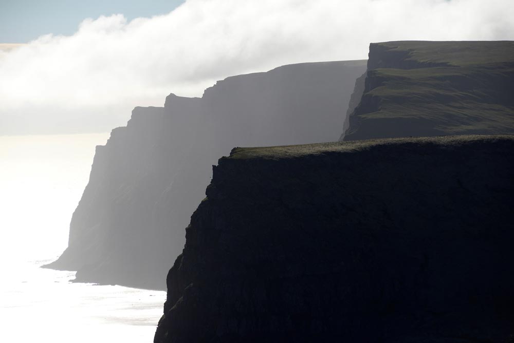
The island is first mentioned by a Greek explorer in 360 BC as he writes down he sailed for six days from the shore of Scotland and came to a land he calls Ultima Thule. So there was knowledge about this island and later Vikings with great skills in shipbuilding and navigating began to sail the Atlantic Ocean. According to one of the Sagas, The Book Of Settlement “Landnámabók”, the settlement of Iceland began in the year 874 when the Norwegian chieftain Ingólfur Arnarson became the first settler on the island.
There were a few others who tried to settle before including Floki Vilgerdarson called Hrafnafloki and he is responsible for the name Iceland because of his bad experience and left the island. In the years from 870 to 950 mostly Norwegians, but also some from Sweden and Denmark decided to settle in Iceland, bringing with them thralls of Gaelic origin. The island was governed as an independent commonwealth under the Althing, one of the world’s oldest functioning legislative assemblies. Following a period of civil strife, Iceland acceded to Norwegian rule in the 13th century. In 1814, it came under the rule of Denmark, during which a distinct Icelandic national identity emerged.
This culminated in independence in 1918 and the founding of a republic in 1944. Until the 20th century, Iceland relied largely on subsistence fishing and agriculture and was among the poorest in Europe. The industrialisation of the fisheries and Marshall Plan aid following World War II brought prosperity, and Iceland became one of the wealthiest and most developed nations in the world. In 1994, it became a part of the European Economic Area, which further diversified the economy into sectors such as finance, biotechnology, and manufacturing.
Iceland’s Economy.
Iceland has a market economy with relatively low taxes compared to other OECD countries.[9] It maintains a Nordic social welfare system that provides universal health care and tertiary education for its citizens.[10] Iceland ranks high in economic, political and social stability and equality. In 2013, it was ranked as the 13th most-developed country in the world by the United Nations Human Development Index.[6] Iceland runs almost completely on renewable energy. Affected by the ongoing worldwide financial crisis, the nation’s entire banking system systemically failed in October 2008, leading to severe depression, substantial political unrest, the Icesave dispute, and the institution of capital controls. Many bankers were jailed, and the economy has made a significant recovery, in large part due to a surge in tourism.
Culture.
Icelandic culture is founded upon the nation’s Scandinavian heritage. Most Icelanders are descendants of Germanic and Gaelic settlers. Icelandic, a North Germanic language, is descended from Old Norse and is closely related to Faroese and West Norwegian dialects. The country’s cultural heritage includes traditional Icelandic cuisine, Icelandic literature and medieval sagas. Iceland has the smallest population of any NATO member and is the only one with no standing army, its lightly armed coast guard being in charge of the defence.
The Capital
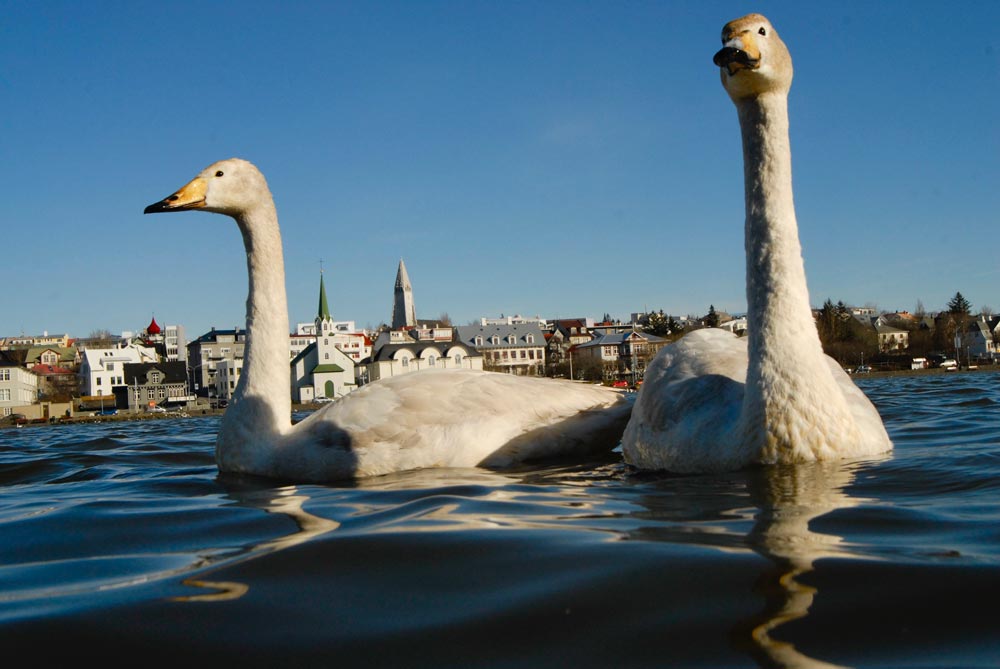
Reykjavik is the capital of Iceland with about 128,000 inhabitants (2019) or nearly 40% of the total population of Iceland. It has the government, Parliament and most of the government offices. The Parliament “Althing”, which is considered to be the oldest in the world, assembled in Reykjavik in 1845. The city is spread over a vast area (242 km²) but the distances to reach natural surroundings are short. “Ellidaar River”, one of the country’s salmon rivers, runs right through town and anglers are often landing salmon from this clear and unpolluted river under the bridge of a busy motorway. Iceland’s first settler, Ingolfur Arnarson, made his permanent residence in Reykjavik in the year 874 according to one of the Sagas “The Book of Settlement” and the area has been inhabited ever since. Upon arrival, Ingolfur saw steam rising from hot springs near a cove and therefore named the bay “Reykjavik” – The Smoky Bay.
There are many boreholes used to reach to geothermal water and now the hot water is pumped directly from the ground into all houses in the greater capital area providing inexpensive central heating and resulting in a smoke-free city in fact today more than 90% of homes in Iceland are heated with geothermal water.
Hafnarfjordur.
This town is also known as The Town in the Lava Field or The Town of the Elves. It received its municipal rights in 1908 and developed around one of the most important trading posts for centuries. It is the fourth-largest town in the country. It is beautifully situated in the lava landscapes and has a very nice, small park called Hellisgerdi in the old centre. The town has a very good, natural harbour, which is among the main attractions. Down by the harbour is the Viking restaurant Fjorukrain, which offers deep-sea angling and whale-watching tours as well as good food. The Hotel Viking is a part of the same operation. Every summer the very popular Viking Festival is celebrated for almost a week. It attracts visitors from all over the world. Hafnarfjordur offers all the necessary services to the visitors, its cultural life is highly interesting and there are fishing lakes nearby. The golf course on the hill Hvaleyrarholt is very popular. The distance from the capital is 12 km.
Geysir.
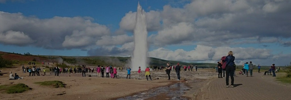
This most famous and former largest spouting hot spring of the world probably was created during an extended earthquake period at the end of the 13th century. According to one of the annals, two large hot springs were created in the Haukadalur Valley in 1274, and many were ruined and disappeared. Silica deposits have created a mound around Geysir and its bowl measures about 18 metres across. The main natural shaft of the spring is 18 m deep and 2 m across.
For centuries on end, Geysir erupted and attracted tourists, but after the turn of the 19th century its activity diminished and after 1916 it has been very irregular. Scientists concluded that its cooling surface was too large and reduced it in size with good results for a spell. The highest measured eruptions reached over 80 m and before it erupted it rumbled and small tremors were felt. The hot spring area surrounding Geysir is about 500 m long and 100 m wide.
The ancient silica deposits cover a much larger area, close to 200 thousand square meters, which confirms the existence of a much larger hot spring area in the past. There are dozens of hot springs within the present active area and some of them spout as Geysir did. The most prominent one is Strokkur (The Churn), which spouts at intervals of 3-5 minutes. The hot spring area is fenced off and was declared inviolate in 1953.
Gullfoss.
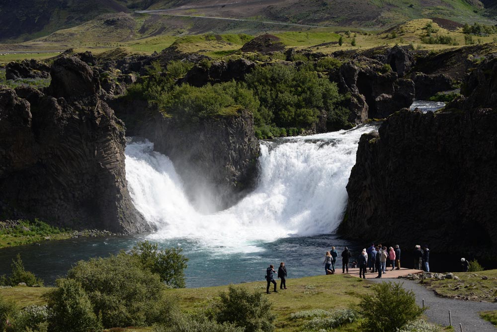
The Golden Waterfall (Gullfoss) is situated in the upper River Hvita (White River). The water cascades down two steps, one 11 m high, and the other 22 m, into the roughly 2 km long canyon below the waterfalls. This canyon was created at the end of the Ice Age by catastrophic floods and is lengthened by 25 cm a year by constant erosion.
Above the waterfalls are dangerous rapids. History tells us about daredevils, who forded the river there. One of them was a young man, who watched his father’s sheep every summer on the west bank of the river. On the other side, a young woman did the same thing for her family. They started shouting across the river and became acquainted that way. Eventually, the young man proposed to the girl across the river and she accepted on the condition, that he come right away to seal their agreement. He did that and of course, they lived happily ever after.
In 1930 and 1948, the river was flooded to the brim of the canyons and both times bridges further down the river were swept away. Early in the 20th century, the farmer of Brattholt, who owned the water rights of the river contracted them to an English firm for a hydroelectric power station. The farmer’s daughter opposed this and even threatened to throw herself into the waterfall to prevent this environmental accident. She fought bravely alone until a young lawyer, who later became the country’s first president, came to her to assist in the fight to save the waterfall. Together they managed to conquer and she was commemorated by a monument in the canyon by the waterfalls in 1978.
In the canyon, alternating strata of lavas and moraines (till/tillite) are obvious and tell us about the warm and cold epochs of the Ice Age.
Sigríður Tómasdóttir was born in Brattholt in 1874 and lived there her whole life. Sometimes it was quite lively at the farm because visitors came from all corners of the world to see the renowned waterfalls Gullfoss.
The sisters at the farm were very fond of the waterfalls and acted as guides for the visitors. The sisters laid the first path to Gullfoss. Sigridur did not receive any official education but was well-read and artistic, a good illustrator and a skilled embroiderer.
At the turn of the 19th century, foreign investors were interested in exploiting Icelandic waterfalls for electrical production. An Englishman was interested in Gullfoss and offered Tomas, Sigridur’s father, 50,000, oo Ikr. for the waterfalls, but his answer was: “I do not sell my friends”. Financiers, who later got their hands on the waterfalls, wanted to harness them. Then Sigridur’s fight to save the waterfalls started. Her opponents were many of the country’s most powerful and richest men. She took on many long and difficult journeys, i.e. walks to Reykjavik (120 kilometres one way) to further her cause. At a time, when all seemed lost, she threatened to throw herself in the waterfalls. Fortunately, it did not come to that, because of the help of her lawyer Sveinn Bjornsson, who later became the first president of Iceland. They managed to have the contract annulled and Gullfoss became the property of the people of Iceland.
Sigridur died in 1957 and was buried in the Haukadalur cemetery. She will always be remembered as the saviour of Gullfoss. The sculptor Rikhardur Jonsson made her memorial, which is standing by the waterfalls.
Source: Brattholt’s website.
Landmannalaugar.
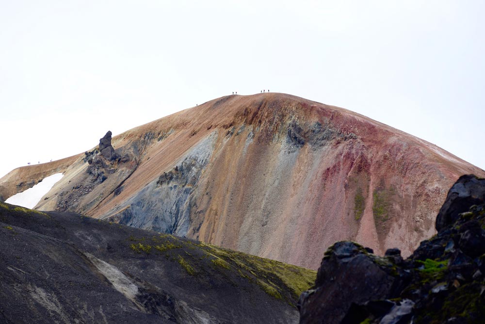
Landmannalaugar is a place in the Fjallabak Nature Reserve in the Highlands of Iceland. It is at the edge of the Laugahraun lava field, which was formed in an eruption around the year 1477. It is known for its natural geothermal hot springs and surrounding landscape.
Landmannalaugar is the northern end of the Laugavegur hiking trail and a popular destination for tourists travelling in Iceland. The Iceland Touring Association operates a mountain hut with sleeping bag accommodation for 75 people and a public toilet with showers. During the tourist high season, there is also a small shop that sells coffee and basic groceries and a horse tour agency. ICE-SAR highland patrol in Fjallabak operates from here.
This jewel of the interior is situated in a valley between colourful mountains at the dark edge of the rhyolite lava field Laugahraun. Many hot and cold springs create a warm bathing brook, where people bathe. The banks of the brook are boggy and lush vegetated and people are kindly asked to use the wooden path across the bog to the brook. It is forbidden to use soap in the brook. The surroundings of Landmannalaugar are too colourful and magnificent to describe with words. The mountains are split with gullies and gorges, one of which, the Jokulgil, is about 13 km long.
It is possible to hike all the way to its end when the river is not swollen, and there are several other hiking possibilities in the area. Landmannalaugar is also the starting point for those, who want to hike to the Thorsmork area in the south. It is easy to walk there in three days, but many prefer to spend more time en route to be able to enjoy the trip to the utmost. The tourist hut in Landmannalaugar accommodates 110 or more people and there is a camping area, where it is extremely difficult to drive the pegs into the ground, and if it starts blowing hard, rocks have to be used to weigh the tents down. People are kindly asked to return the rocks to the wooden crates after use. Landmannalaugar is a part of a larger nature reserve.
NATIONAL PARK SNAEFELLSJOKULL.
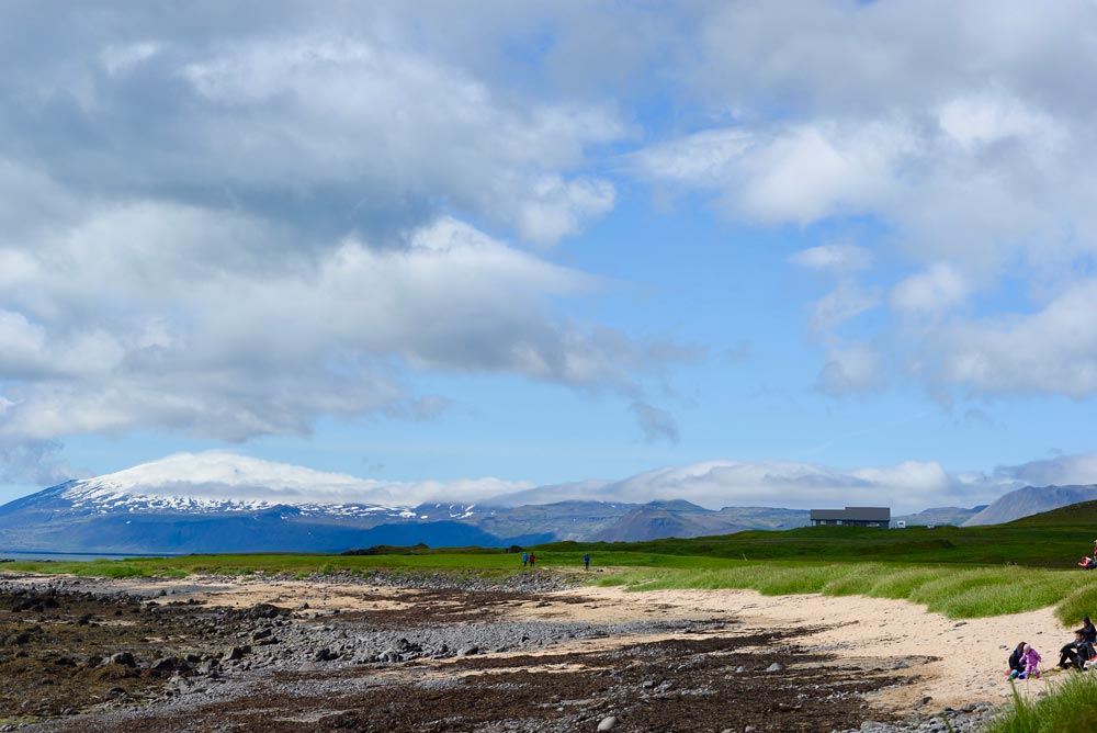
The Snaefellsjokull National Park was officially established on the 28th of June 2001, thus becoming the fourth national park of the country. Its boundaries follow the eastern border of the Gufuskalar estate on the northern part of the peninsula, a line east of the glacier and along the eastern edge of the Haahraun lava field to the Gjafavik cove in the south.
Within its boundaries are highly interesting geological phenomena and historical sites. According to geological findings, the volcanic drift belt crossed the Snaefells Peninsula about 6 million years ago. The volcanic activity at that time was similar to the one now experienced in the present volcanic area. Rivers, and later the ice age glaciation, carved the country and removed 500-1000 metres off the lava plateau. Intrusions of rhyolitic rock were created and sedimentation covered the base rock. Volcanic activity started again about 2 million years ago, mainly in the Ljosufjoll, the Lysuskard and Snaefellsjokull areas. This activity was unlike the earlier volcanism, because of the lack of drift and the different composition of the tephra. The Snaefellsjokull area extends from Mt. Maelifell in the east and the headland Ondverdarnes in the west.
The most obvious lava fields in the westernmost part of the peninsula are Budahraun, Hnausahraun, Klifhraun, Hellnahraun, Haahraun, Neshraun, Saxholahraun, Prestahraun and Vaejuhraun. All of them are rugged AA-lavas except Neshraun, which is Pahoehoe lava, created by the caters Ondverdanesholar. The lava fields Hnausahraun, Klifhraun, Hellnahraun and Vaejuhraun are probably younger than 1750 years, but the Haahraun was created by an eruption of the main crater of the Snaefellsjokull 1750 years ago.
During the earlier centuries, there was much activity along the coastline. Wherever natural conditions permitted there were fishing outfits, where hundreds, if not thousands, of fishermen, who frequented the rich fishing grounds near the coast, used open rowboats. The most renowned among them is Dritvik, where the fisheries probably started in the 16th century, and according to the annals between 300 and 400 fishermen, using 60 boats, spent the time during the fishing seasons. Ruins of their abodes and a lava maze on the hill south of the cove are protected.
Other historic monuments are scattered within the national park limits, some of which are connected with legends and historic novels. Two novels have put the Snaefells Peninsula permanently on the map, Jules Verne’s novel “The Journey to the Centre of the Earth”, and Halldor Kiljan Laxness’ novel “Christianity under the Glacier”. (Picture: waterfall Klukkufoss).
According to the goal of the legislation concerning the protection of nature, the emphasis is put on making the national park easily accessible for the public and the availability of information about historic and cultural sites. The staff of the national park will be able to receive school classes and other groups to educate them and take them around on sightseeing tours.
Tourism and quality services within the park are the main goals for the future. As before, individual travellers, as well as groups, will frequent this area, and maps with hiking trails and spots of interests will help them enjoy this remarkable part of the country to the fullest. The Nature Preservation Institute is responsible for the national park and its 5 years protection plans.
COVES DJUPALON & DRITVIK.
Djupalon is a pebble beach cove with bizarre lava formations and gorges at its end. From there it is only one kilometre’s walk to the west along the coastline to another cove, where there are prominent ruins of fishermen’s huts, sheds for storing the catch after processing it and lava walls used for drying the flattened fish in the sun. All the huts and sheds in Djupalon were washed away by the sea, but a replica of one of them was built there to give people some idea of how they looked.
It is estimated that there were between 60 and 70 fishing outfits situated on the cove Dritvik and the number of fishermen and their housekeepers was between 300 and 400. The fisheries from the Dritvik Cove started as early as the 16th century and continued into the 19th. The only house standing on the Dritvik Cove now is a refuge hut for the seafaring people, who run aground in that area.
At the beach are situated 4 big stones which people tried to lift and test their strength: Fully Strong 154 kg, Half-Strong 100 kg, Weakling 54 kg and Bungler 23 kg.
The latest such incident happened only a few decades ago. No one travelling around the Snaefellsnes peninsula should miss visiting these coves. It is only a short detour of 3 kilometres each way from the main road.
The iron wreckage on the beach partly belongs to the British trawler Epine GY-7, which ran aground just east of the skerry Dritvikurflogur in the evening of March 13th 1948. Rescue Corps from Arnarstapi, Hellnar and Hellissandur came immediately to the rescue. They saw the crew seeking shelter on board, some tied to the mast when the breakers of the high tide hit the vessel. One man was washed ashore and lived. The rescue teams could not shoot a line to the trawler until the tide went out when only four crewmembers were left alive. They were brought ashore in the rescue stool. More vessels have run aground in the same area, such as the trawler Asa RE-18 on December 21st 1925. The crew got into one of the lifeboats and spent seven hours there before a Norwegian freighter and a German trawler came to the rescue.
Visitors are kindly asked not to move the wreckage!
LONDRANGAR – THUFUBJARG
Londrangar is two prominent rocks, protruding from the coast just east of the lighthouse at Malarrif on the southern side of the Snaefellsnes peninsula. A few minutes’ walk up the well-vegetated hill Svalthufa takes you to the edge of the Thufubjarg cliff to watch the interesting bird life, such as guillemots and kittiwakes. From there, it is easy to walk down to the Londrangar pillars.
They and the hill are the remnants of a crater, which has been eroded to its present form by the sea. The farmers in the area never made or make hay on the hill, because it is said to belong to the elves living in the area. Younger lava fields surround this old crater ruin. The higher pillar was first climbed in 1735 and the lower in 1938.
Just east of the higher one are ruins of fishermen’s huts and walls made of lava stones, which were used for drying fish. There were quite a few fishing outfits there and further to the west at Malarrif on this dangerous and harbourless stretch. The lighthouse was built in 1917 and rebuilt in 1946. The radio beacon was placed there in 1955.
How to get there
Before Entering the Interior Highlands Check Your Nearest Information Centres!
This pearl of the interior is situated in a valley between colourful mountains at the dark edge of the rhyolite lava field Laugahraun. Many hot and cold springs create a bathing warm brook, where people bathe. The banks of the brook are boggy and lush vegetated and people are kindly asked to use the wooden path across the bog to the brook. It is forbidden to use soap in the brook. The surroundings of Landmannalaugar are too colourful and magnificent to describe with words. The mountains are split with gullies and gorges, one of which, the Jokulgil, is about 13 km long.
It is possible to hike all the way to its end when the river is not swollen, and there are several other hiking possibilities in the area. Landmannalaugar is also the starting point for those, who want to hike to the Thorsmork area in the south. It is easy to walk there in three days, but many prefer
to spend more time en route to be able to enjoy the trip to the utmost. The tourist hut in Landmannalaugar accommodates 110 or more people and there is a camping area, where it is extremely difficult to drive the pegs into the ground, and if it starts blowing hard, rocks have to be used to weigh the tents down. People are kindly asked to return the rocks to the wooden crates after use. Landmannalaugar is a part of a larger nature reserve.
Thorsmork.
Thorsmork is one of the brightest jewels of beautiful areas of the country, surrounded by rugged and majestic mountains, glaciers and glacial rivers, decorated with small birch woods and silver lined with humming streams. It is rather difficult to describe the charm of this area. It has been tried in the already existing literature with various results. The Icelanders appreciate Thorsmork (The Forrest of Thor) much and visit it frequently the whole year round. Quite a few streams and rivers have to be forded to get there and no one should attempt that without the company of experienced people. The glacial rivers are unpredictable and the water flow changes constantly and unpredictably. A newly added feature of attraction is a hot pool “Þórslaug”, to add to the delight of staying in Þórsmörk. Be sure to bring your swimwear with you!
Just north of Thorsmork and east of River Markarfljot are the barren summer pastures of County Western Eyjafjoll. Still further north are the summer pastures of County Fljotshlid. Hikers on the trail between Thorsmork and Landmannalaugarpass through those areas. This extremely popular hiking trail starts or ends here. A hiking trail from Thorsmork to Skogarcrosses Pass Fimmvorduhals.
The distance from the capital is about 150 km.
Eyjafjallajokull eruption 2010.
On March 20th 2010 just before midnight a half a kilometre long fissure opened up and an eruption started just to the west of the hiking trail Fimmvorduhals. Earthquakes and tremors had been monitored since the summer of 2009. The authorities were well prepared for the measures to be taken in case of an eruption. People were temporarily evacuated from the area and roads were closed. They were opened again in the afternoon. Scientists say that this eruption counts among the small ones. Lava started flowing across the hiking trail, down into the Hrunagil gorge on the 22nd, melting snow and causing temporary swelling of river Krossa.
Eyjafjallajokull Eruption!
On March 31st, an NW-SE eruptive fissure opened up a bit further northwest of the original crater, which remained active. Molten lava flowed from the new fissure down into the Hvannargil gorge further north and added to the lava volume.
April 13th – 14th 2010. No emission of lava from the fissure of March 31st. Eruption pause or end.
April 14th 2010. Shortly after midnight, the mountain massif Eyjafjoll’s caldera started erupting. Flood waves rushed in two directions, mainly to the north into river Markarfljot’s wide valley, threatening farm communities and communications on rd 1 the Ring road, which was removed partly to save a relatively new bridge. Approximately 700 people were evacuated from their homes. The flood wave to the south threatens an inhabited area around farm Thorvaldseyri and will cause damage to rd 1, fields and meadows. The westerly winds carried ash and tephra eastwards, where large areas were covered. It is estimated that the tephra distribution might disturb air communications to Northern Europe (Scandinavia) in the next few days. The westerly winds carried ash and tephra eastwards, where large areas were covered. It is estimated that the tephra distribution might disturb air communications to Northern Europe (Scandinavia) in the next few days.
May 3rd 2010. The last few days, one crater has been active in one of the ice cauldrons. Lava has been flowing to the north under the glacier tongue Gigjokull and increasing meltwater on the outwash plain. Today the temperature of the main glacial river, Markarfljot, was measured 11-17°C at the old bridge (1934).
A German research plane flew to the southeast along the ash plume, which is carried at relatively low altitudes (>20 thousand feet), and reported high density of the ash all the way down to the latitude 60°N, which might cause some disruptions of flights. Airports in Ireland and Scotland were closed as a result (May 4th and 5th).
According to scientists, the eruption is now more intense than in the beginning, but the ash (tephra) distribution is less likely to cause trouble because of coarser particles.
May 23rd 2010. The eruption has been dwindling during the week. A reporter flew over the crater in the afternoon and saw no sign of activity. The volcano has paused or the eruption is over.
The road to Thorsmork is open for 4×4 cars going to Thorsmork
Thórsmörk (Icelandic: Þórsmörk, is a nature reserve in Iceland and was named after the Norse god Thor (Þór). It is on the south of Iceland between the glaciers Tindfjallajökull and Eyjafjallajökull. The name “Thórsmörk” properly refers only to the mountain area between the rivers Krossá and Markarfljót, but usually describes a wider area that includes the region between Thórsmörk and Eyjafjallajökull. Thórsmörk is one of the most popular hiking areas in Iceland because of its dramatic and breathtaking landscape.
In the valley, the river Krossá winds between the mountains. The valley is closed in between glaciers, Mýrdalsjökull being at the rear end of the valley. This leads to an especially warm climate, better than in the rest of south Iceland. In the protected valley, green vegetation of moss, fern, birchwood, and other small shrubs are found.
Thórsmörk is popular amongst hikers. Many different tours are possible, from hiking on the glaciers to trekking (i.e., Laugavegur up to Landmannalaugar) or smaller excursions, such as to the canyon Stakkholtsgjá with its waterfall or five small day treks, to the summits of surrounding peaks, with rewarding views, even in bad weather. The Krossá is a fast and unpredictable river coming down from glaciers; a bridge allows pedestrians to cross.