Iceland guide
Snæfellsnes, Iceland in Miniature
The Snæfellsnes peninsula in West Iceland packs much of the country into one day trip: black and golden beaches, lava fields, sea cliffs, fishing villages, Kirkjufell mountain and the Snæfellsjökull glacier at its tip. Here is the route from Reykjavík, the stops in order, how long it takes and how it compares with the busier trips in the south.
At a glance
- Where
- West Iceland, about 2 hours north of Reykjavík
- Distance
- Roughly 400 km round trip
- Driving
- About 6 hours without stops
- A full day
- 10–12 hours with stops
- Season
- All year; daylight is short in winter
- Entry
- No entrance fees; some car parks charge
What and where is Snæfellsnes?
Snæfellsnes is a peninsula about 90 km long, reaching west into the Atlantic north of Reykjavík. At its tip stands Snæfellsjökull, a 1,446 m glacier-capped volcano that you can see from Reykjavík across the bay on a clear day. The area around it became Snæfellsjökull National Park in 2001.
It is often called Iceland in miniature, because so much of what the rest of the country is known for is found here within a few hours’ drive: lava fields, black and golden beaches, basalt cliffs, small fishing villages, a glacier and one of the most photographed mountains in Iceland.
Snæfellsnes map and route from Reykjavík
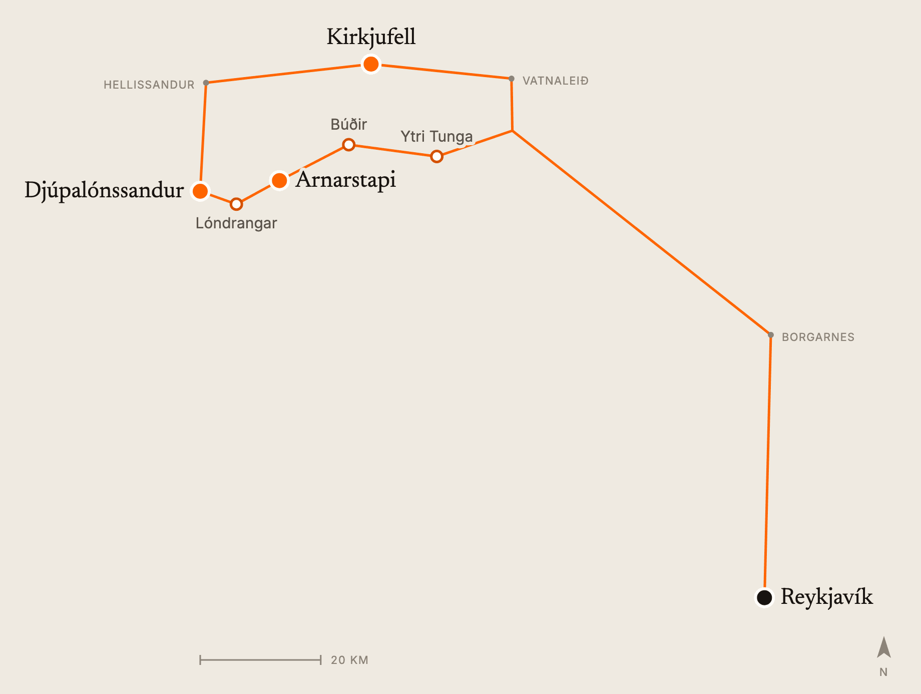
From Reykjavík the road goes north through the tunnel under Hvalfjörður to Borgarnes, about an hour away, then west along the south side of the peninsula. Most days run clockwise: the south coast and the national park first, around the tip, then along the north side to Kirkjufell and back over the mountain road Vatnaleið.
The round trip is roughly 400 km, around six hours of driving without stops. With time at each place it is a long day of ten to twelve hours, which is why a lot of people stay a night on the peninsula.
The stops on the way
These are the places our Snæfellsnes tour stops at, in order, with a couple more that sit right on the road.
Ytri Tunga
A beach with a seal colony on the rocks just offshore. The seals are most reliably there in summer.
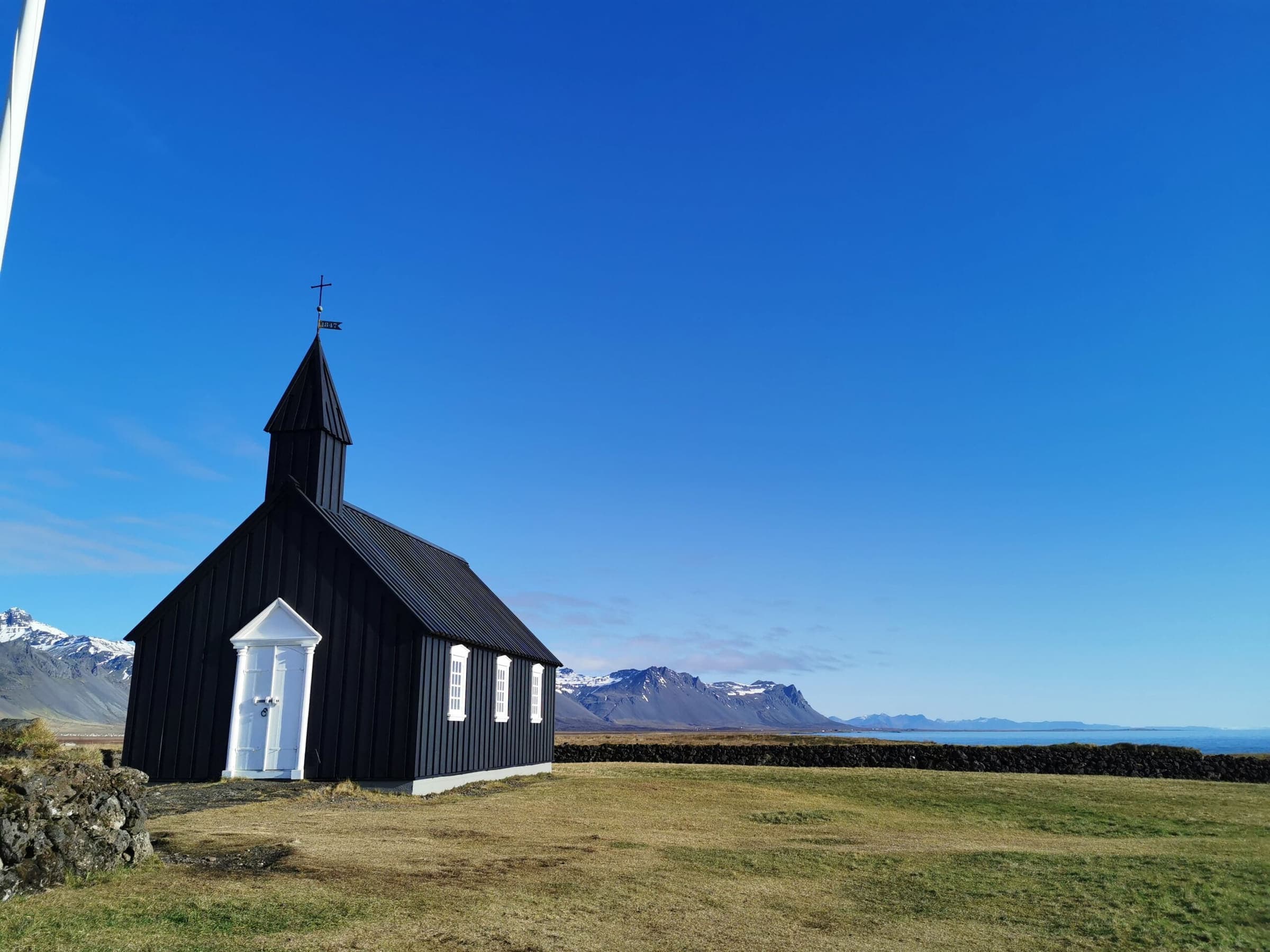
Búðir
A tiny hamlet with a black wooden church standing alone on the lava field, with the mountains behind it.
Arnarstapi
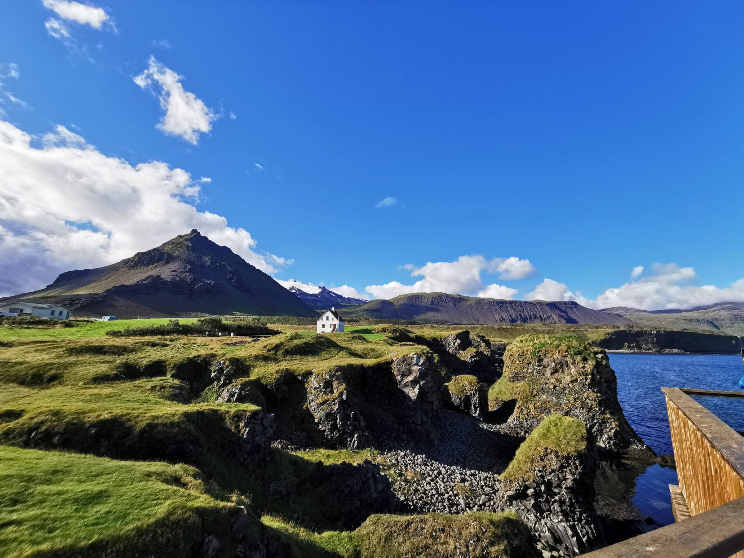
A small fishing village on the sea cliffs. Walk through the lava to the Gatklettur arch, or follow the coastal path to Hellnar, about 2.5 km away.
Lóndrangar
Two tall rock pillars on the coast, the remains of an old crater, with sea birds on the cliffs beside them. More on our About Iceland page.
Djúpalónssandur
A black pebble beach scattered with the iron wreckage of a British trawler lost in 1948, and the four lifting stones fishermen once used to test their strength. More on our About Iceland page.
Kirkjufell
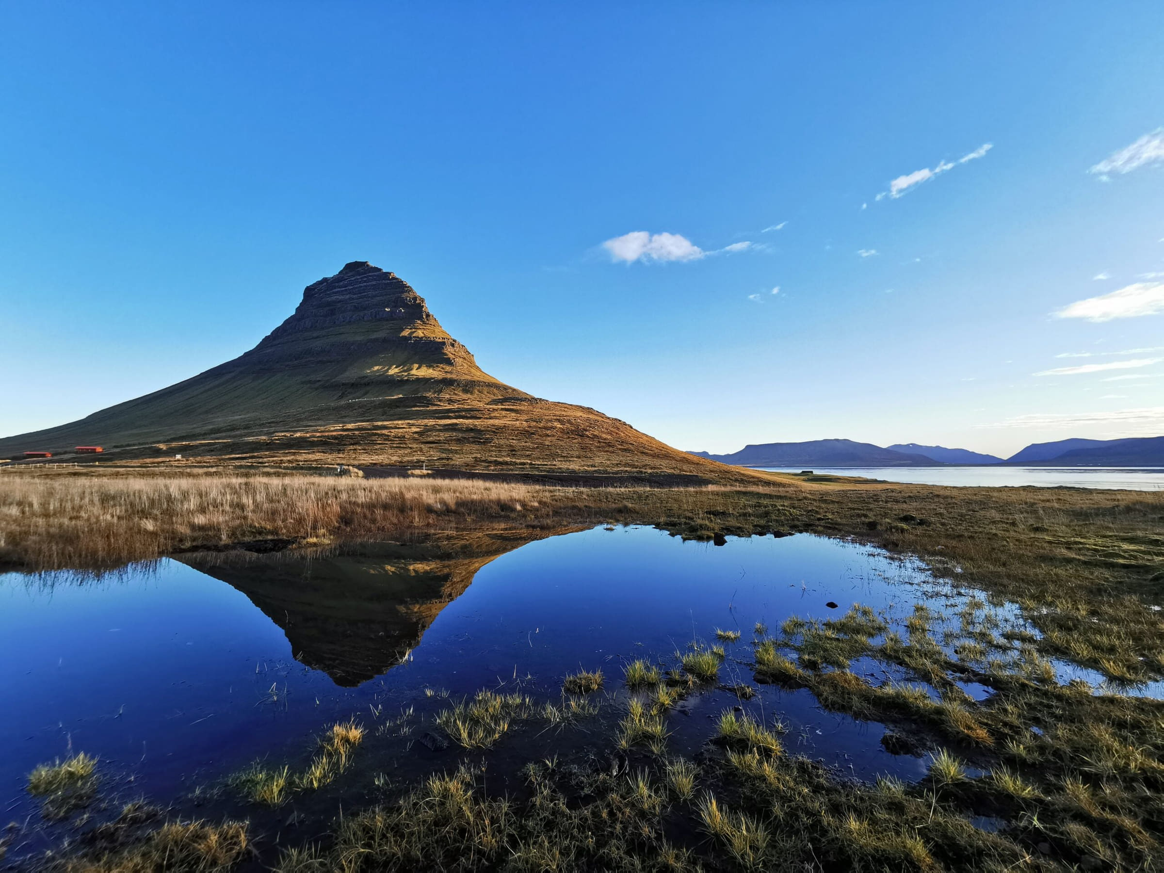
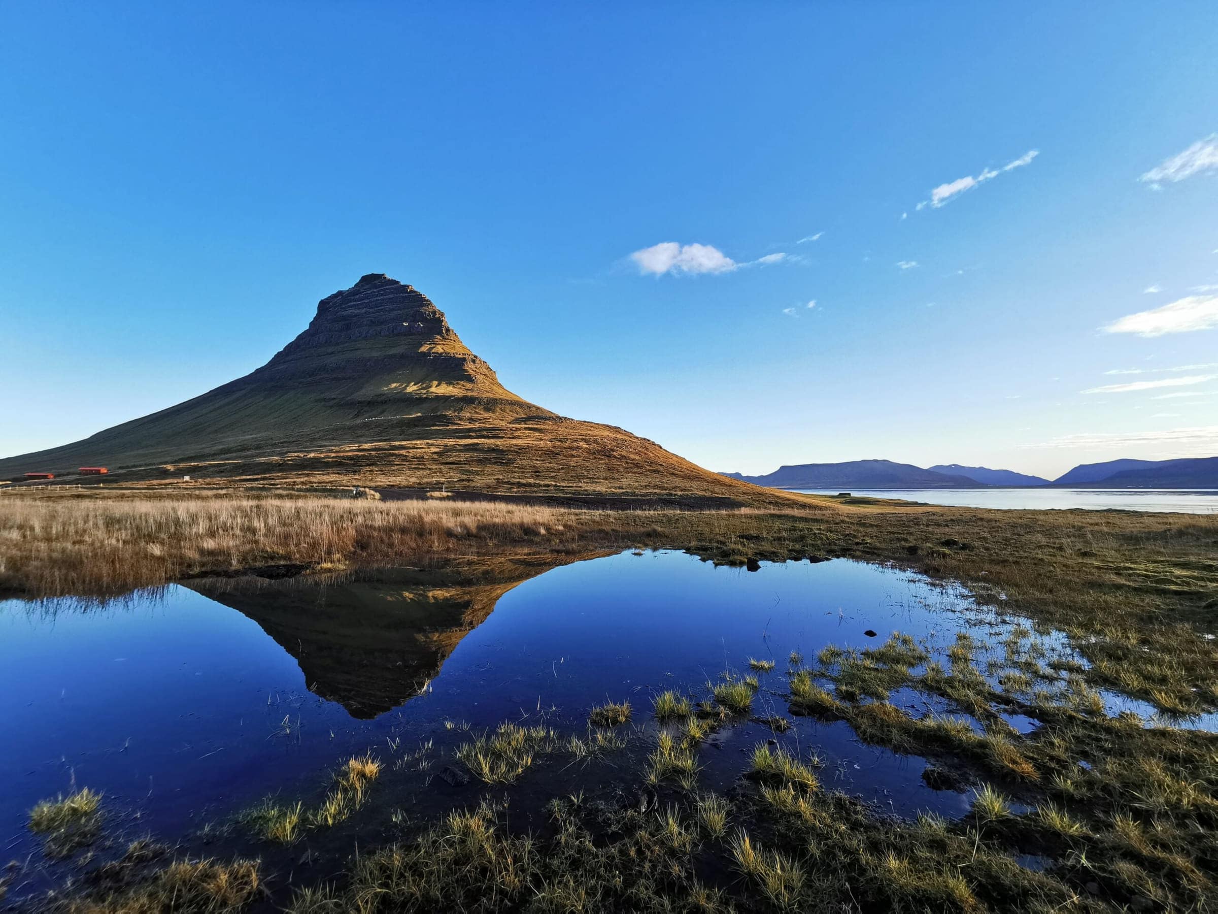
The 463 m mountain at Grundarfjörður, with the small Kirkjufellsfoss waterfall in front of it. The classic photo is taken from beside the falls.
Snæfellsjökull, the glacier at the end of the world
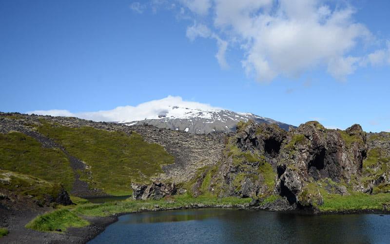
The glacier volcano at the tip of the peninsula sets the scene for the whole day: it comes into view from the south coast and stays in sight until you round the tip. Jules Verne chose it as the entrance in Journey to the Centre of the Earth, and Halldór Laxness set Christianity at the Glacier here. The national park’s history is on our About Iceland page.
The road around the tip runs through the national park, past lava fields, craters and the coves where fishermen once camped for the season. On a clear day the glacier is the backdrop to almost every stop.
Snæfellsnes in winter
The peninsula is open all year, and the main roads are kept clear. Short winter days are the real limit: in December there are only four to five hours of daylight, so the day starts and ends in the dark, and the mountain roads can close for a while in a storm.
The dark has its own reward. On a clear night Kirkjufell under the northern lights is one of the best-known views in Iceland; see our northern lights guide for when to come.
Is Snæfellsnes worth visiting?
Yes, especially if you have already done the Golden Circle or the South Coast, or if you would rather not share every viewpoint with a coach. It is quieter than the south, more varied than either, and the drive along the coast is part of the trip.
The trade-off is the distance. As a day trip it is long, so it suits people who don’t mind time on the road, or anyone with a night to spend on the peninsula.
FAQ
Questions about Snæfellsnes
How far is Snæfellsnes from Reykjavík?
The south side of the peninsula is about two hours’ drive from Reykjavík, and Kirkjufell about two and a half. The full loop is roughly 400 km.
Can you see Snæfellsnes in one day?
Yes, as a long day of ten to twelve hours from Reykjavík. To take it slower, spend a night on the peninsula.
Is Snæfellsnes worth visiting?
Yes. It packs beaches, lava fields, sea cliffs, a glacier and Kirkjufell into one trip, and it is quieter than the Golden Circle or the South Coast.
Where should I stay on Snæfellsnes?
Arnarstapi and Búðir on the south side, or Grundarfjörður and Stykkishólmur on the north side. All have places to stay.
Can you visit Snæfellsnes in winter?
Yes. The main roads are kept open all year. Plan around the short daylight and check the road conditions on the day.
What is there to do on Snæfellsnes?
Watch seals at Ytri Tunga, walk the cliffs between Arnarstapi and Hellnar, see the lifting stones at Djúpalónssandur, photograph Kirkjufell and its waterfall, and drive through the national park around the glacier.
Contact us for a quote
Contact Us for Personalized Tours
Enjoy a private day tour in Iceland, contact us for a quote today.